

From the Ardèche Gorges to the Pont d’Arc, these maps will help you gain a better understanding of this spectacular region and plan your exploration. Here you’ll find the key landmarks to help you explore the gorges – on foot, by canoe or by car – between the Cévennes, the Bas-Vivarais and the Gates of the Gard.

Maps of the Ardèche Gorges
Where exactly are the Ardèche Gorges? Where is the Pont d’Arc, and how far does the famous canoe trip extend? To answer these questions, a map remains one of the best tools for understanding the geography of this part of southern Ardèche.
The Ardèche Gorges stretch for around thirty kilometres between Vallon-Pont-d’Arc and Saint-Martin-d’Ardèche. They form a vast canyon carved out by the River Ardèche through the limestone plateaus, set against a backdrop of cliffs, caves, beaches and the river’s meandering course. At the entrance to the gorges, the Pont d’Arc is the most iconic landmark: this natural arch, through which the Ardèche flows, marks the entrance to the canyon.
This page brings together a number of maps to help you locate the main sites and plan your exploration of the gorges. A tourist map, a canoeing and kayaking route, walking trails, the GR4, campsites, the nature reserve, access points to the river and an interactive map: each document offers a different perspective on the area.
These cards are particularly useful for answering practical questions:
- Where does the canoe trip down the Ardèche Gorges start?
- Where are the main access points to the river for swimming?
- Where are the campsites for spending the night?
- Which towns and villages lie around the gorges?
- How do you get to the Pont d’Arc?
They therefore provide a starting point for planning a hike, a canoe trip or a sightseeing route in the south of the Ardèche.
Tourist map of the Ardèche Gorges
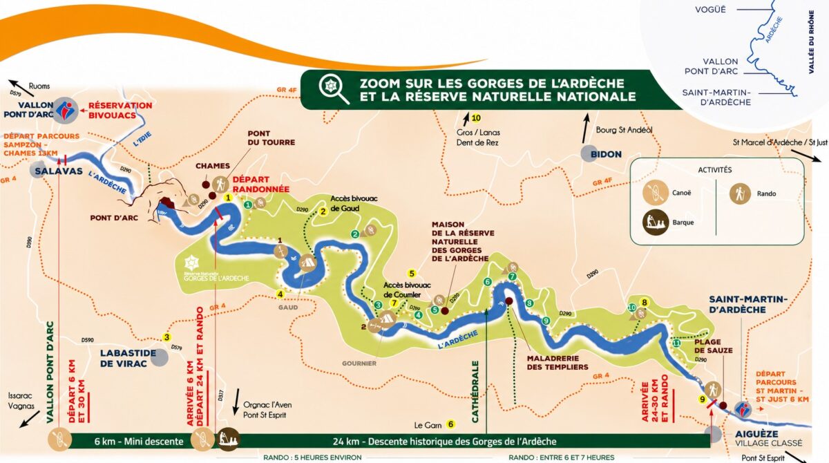
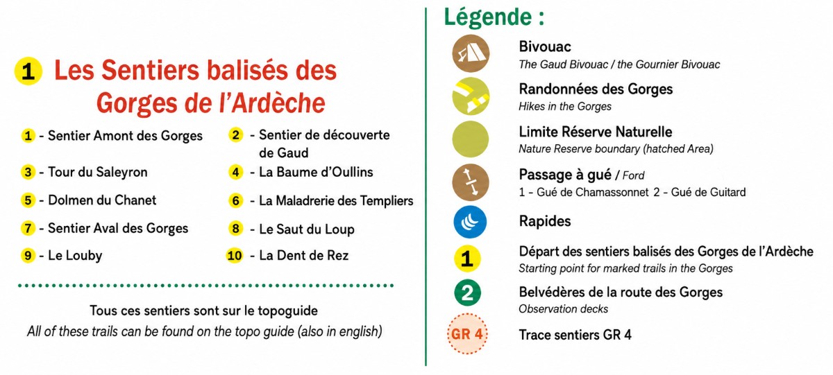
From Salavas to Saint Martin-d’Ardèche, here is a simplified map of the Ardèche Gorges and the National Nature Reserve. It brings together all the essential tourist information in a single image:
Information points, towns and villages, campsites, the boundary of the Nature Reserve, fords, rapids and marked trail routes, including the GR4, with a key provided below the map.
Map of the canoe and kayak route
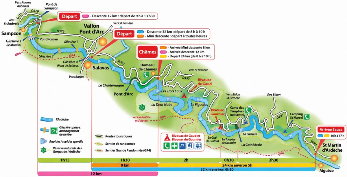
The start and finish points, estimated durations and tourist information for the canoe and kayak trip down the Ardèche Gorges between Sampzon and Saint-Martin-d’Ardèche:
Interactive map
An interactive, tourist and general information map of the Ardèche Gorges, featuring in particular:
- The natural and tourist attractions of the Gorges.
- Leisure activities and caves (admission fee applies).
- Beaches, access to the river, swimming pools, lakes and other bodies of water nearby.
- The Via Ardèche greenway and its junction with Vallon-Pont-d’Arc.
- Where to stay in towns and villages.
- The administrative boundaries of the territory.
Map of the National Nature Reserve
The Ardèche Gorges National Nature Reserve protects nearly 2,000 hectares of cliffs, caves, woodland and river-related habitats, between Vallon-Pont-d’Arc and Saint-Remèze. It can be explored on foot, by canoe or from the viewing points, whilst observing the site’s conservation rules.
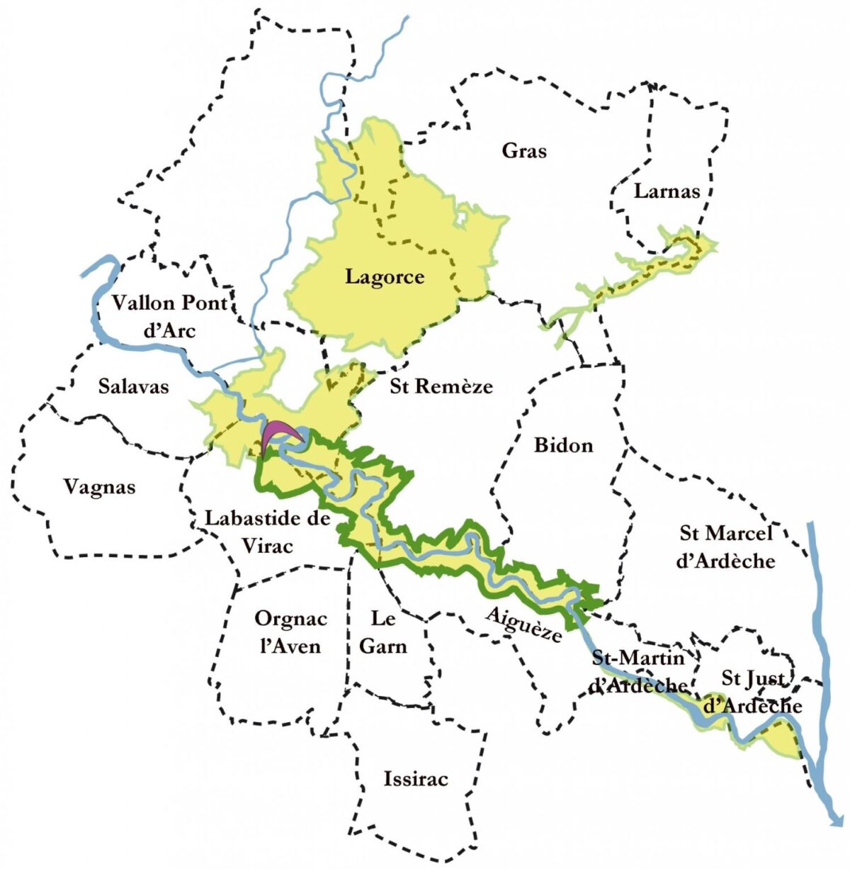
Map of the Gorges de l’Ardèche Joint Authority
The local authorities in the Ardèche and Gard departments that are members of the Syndicat mixte des Gorges de l’Ardèche *, the public body for local cooperation in the region:
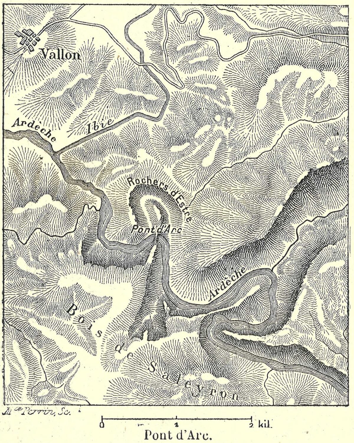
Maps of the Pont d’Arc
In history and geography, two maps focusing on the Pont d’Arc arch in southern Ardèche.
Historical map
Interactive map
Map centred on the Pont d’Arc site in the municipality of Vallon-Pont-d’Arc:
How to get there, where to stay?
Coming soon!
To find out more whilst you wait for further details, please visit the following pages:
➡ Transport in the Ardèche.
➡ How to get there.
➡ Where to stay in the Ardèche Gorges?
Would you like to be notified by email about updates, new maps and publications?
- Gorges de l’Ardèche Joint Association, SGGA ↗