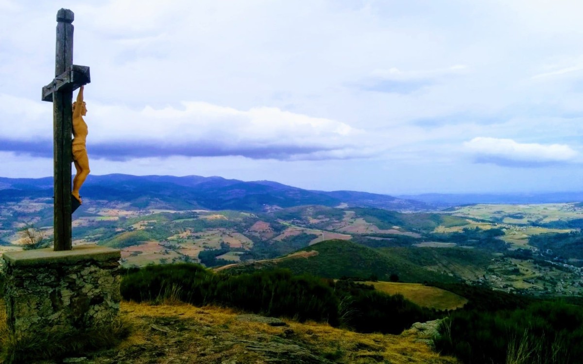
Just a few kilometres from the Ardèche’s largest town, Annonay*, you’ll find the Chirol cross, the highest summit with a panoramic view close at hand.

The Chirol cross in the Ardèche
If you search on a famous online mapping tool, the Chirol cross is first displayed… in the Loire department! Geographical misjudgement by a web giant with no knowledge of the Ardèche 😁
Over and above this location detail, at an altitude of 915 metres, it isone of the most exceptional and easily accessibleviewpoints in the northern Ardèche, easily accessible from the Annonay Rhône* conurbation.
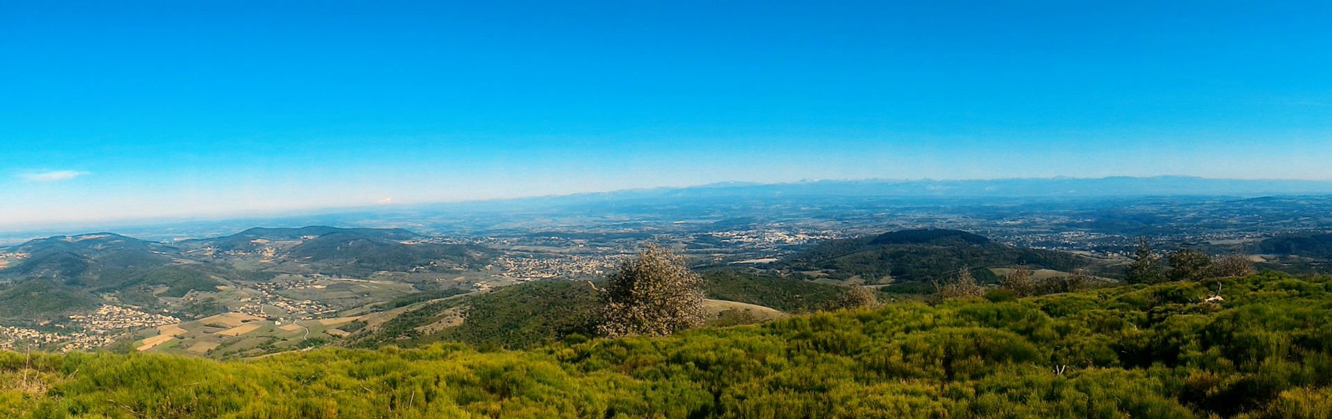
Situated in the commune of Boulieu-les-Annonay, the Croix de Chirol offers a panoramic view of 3 valleys and two eminences, the Massif Central and the Alps.
To get there, you first have to go to the village of Burdignes, the southernmost commune of Pilat, via Bourg-Argental and the Loire department.
For the more courageous, a hike is possible from Bourg-Argental, with a bus stop on the L17 line between Annonay and Saint-Etienne: 625 metres of ascent and more than 5 hours of walking on the programme detailed here.
For the more leisurely, family-friendly version, the best option is to go as far as Burdignes and park in the car park in the village centre. A tarmac road and then a footpath will take you to the summit, crossing the administrative boundary between the Loire and Ardèche departments.
Other departure points for a hike to the site include Sain-Marcel-les-Annonay or Chatinais in Annonay, not far from Montmiandon*.
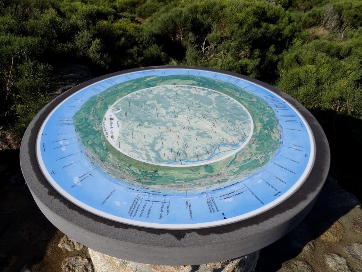
Once you reach the summit, you are greeted by the eponymous cross, with a 360° orientation table a few metres higher up to help you read the sumptuous landscape around you.
The path to Chirol on the map
There are no fewer than 3 hiking trails to choose from, from Burdignes in the Loire, Boulieu-les-Annonay or Annonay in the Ardèche, depending on your mood and stamina.
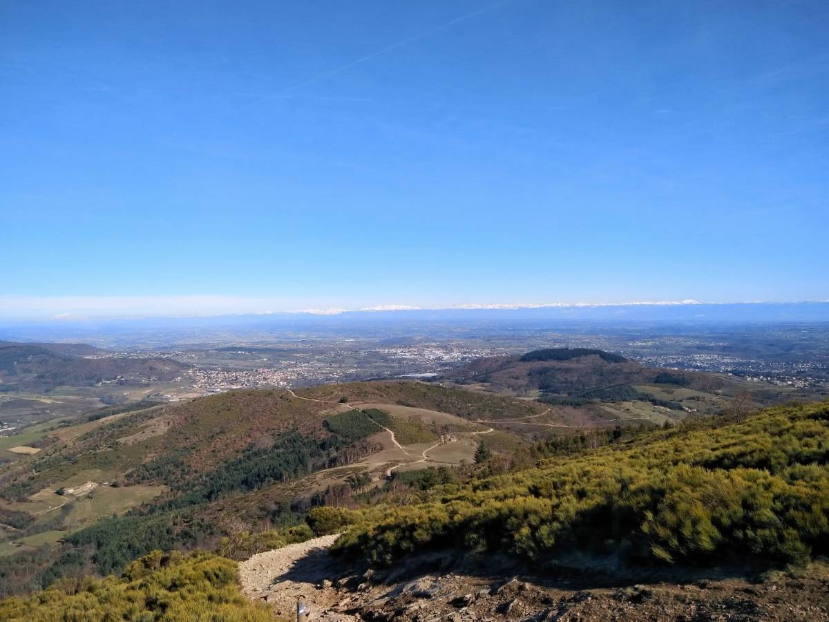
Situated behind Montmiandon, the Chirol cross offers a splendid view over the Annonay-Rhône conurbation.
Paper map showing the area concerned for your walk:
- Ardèche IGN blue TOP25 map 2934 ET / Bourg-Argental, Pilat, Annonay ↗
This magnificent site, on the border of the Ardèche and Loire departments, is fairly easy to reach on foot or by mountain bike, thanks to well-marked paths depending on the route you choose.
Between the religious cross and the orientation table, on a clear day you can admire the Alps and Mont Blanc, the Rhône, Cance and Deûme valleys and, of course, the town of Annonay and the surrounding area.
Where to sleep around Burdignes?
Looking for a hotel, rental, bnb, other accommodation where to sleep in Burdignes and nearby? Here’s a handy map and list of places to stay or visit:

View and photos
Some photos from the Chirol cross in Ardèche :

- Walk and hike at Montmiandon in Annonay
- Around the fire village, the views from Pilat ↗
- The Chirol Cross from Bourg-Argental, Altitude Rando ↗
- Annonay Rhône Agglo?
- Green route in Annonay, the Via Fluvia
- Where to stay in Annonay?